Twin Earthquakes Shake Indonesian Province of Bengkulu

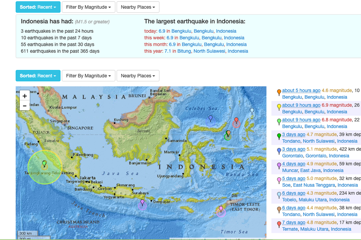
KOMPAS.com – Two earthquakes measuring 6.8 and 6.9 on the Richter scale shook the Indonesian province of Bengkulu in the early hours of August 19. No casualties have been reported.
“The earthquakes are what we would call a doublet as they are of a similar magnitude. They also struck within minutes and in close proximity of each other,” said Meteorology, Climatology and Geophysics Agency (BMKG) Earthquake and Tsunami Mitigation head Daryono.
Also read: Indonesia's Sinabung Volcano Spews Thick Ash Again
“The earthquakes’ epicenter is 78 kilometers offshore of Bengkulu to the southwest, at a depth of 10 and 11 kilometers, respectively. They did not have the potential to bring about a tsunami.”
Daryono added that the earthquakes are caused by friction between the Indo-Australian and Eurasian plates. He noted that the tremors can be felt in the southern part of Bengkulu as well as the Kaur and Curup districts.
“Tremors [from the earthquakes] can be felt by people indoors and outdoors. They are strong enough to crack window frames and walls, as well as rattle the doors,” Daryono pointed out. “The earthquakes also caused people to run out of their houses in mass panic.”
Also read: Series of Earthquakes Rattles Indonesia
He added that the quake left an aftershock with magnitude 4.5 that left no damages. However, Daryono warned the public to beware of aftershocks and fragile structures.
The BMKG said the earthquakes were the first to strike Bengkulu since the province was struck by 96 minor earthquakes last May and June.
Indonesia is long known to be vulnerable to earthquakes, volcanic activity, and other natural disasters due to its geographical location in the Pacific Ring of Fire.
(Writers: Retia Kartika Dewi, Dandy Bayu Bramasta | Editor: Sari Hardiyanto)
Sources:
Simak breaking news dan berita pilihan kami langsung di ponselmu. Pilih saluran andalanmu akses berita Kompas.com WhatsApp Channel : https://www.whatsapp.com/channel/0029VaFPbedBPzjZrk13HO3D. Pastikan kamu sudah install aplikasi WhatsApp ya.


