

Gibran: Time is Up
-
News
-
8 minutes ago
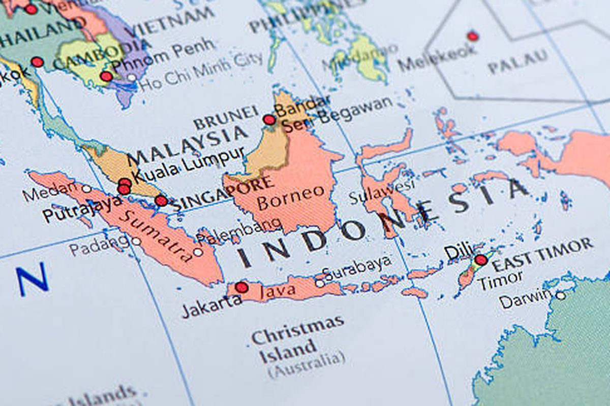
KOMPAS.com - Do you know where Indonesia is located astronomically? According to the Merriam-Webster Dictionary, an astronomical location refers to a place’s position on the globe based on lines of latitude and longitude.
Latitude lines are imaginary horizontal lines that run parallel to the Equator, while longitude lines are vertical lines stretching from the North Pole to the South Pole. These lines are termed “imaginary” because they don't physically exist on Earth, they are used for geographical and astronomical mapping.
Geographically, Indonesia lies between 6° North Latitude and 11° South Latitude, and from 95° East Longitude to 141° East Longitude. These coordinates mark the country’s northernmost, southernmost, westernmost, and easternmost points.
Here are the specific locations at those extremities:
Indonesia is also intersected by the Equator—the 0° latitude line that divides the Earth into the Northern and Southern Hemispheres.
According to the 2018 book Tugu Khatulistiwa ("Equator Monument"), the Equator passes through the following regions in Indonesia:
As outlined in an educational module by the Indonesian civil service program (PPPK), Indonesia’s position has several significant implications:
Tropical Climate:The country experiences consistently warm temperatures year-round.
High Humidity and Rainfall: Abundant precipitation shapes the environment and agriculture.
Biodiversity: The combination of ocean currents and frequent rain helps spread seeds and marine life, fostering rich ecosystems.
Located in the Eastern Hemisphere: Its position places it in the Eastern time zones.
Time Zones: Daily activities are shaped by three official time zones Western Indonesia Time (WIB), Central (WITA), and Eastern (WIT).
Tropical Rainforests: The country is home to vast rainforests, key to global biodiversity and climate regulation.
Sunlight Year-Round: Indonesia receives consistent sunlight throughout the year, supporting agriculture and solar energy potential.
In summary, Indonesia’s astronomical coordinates, stretching from 6° North to 11° South and 95° to 141° East, place it squarely in the tropical belt, shaping the nation’s climate, biodiversity, and way of life.